
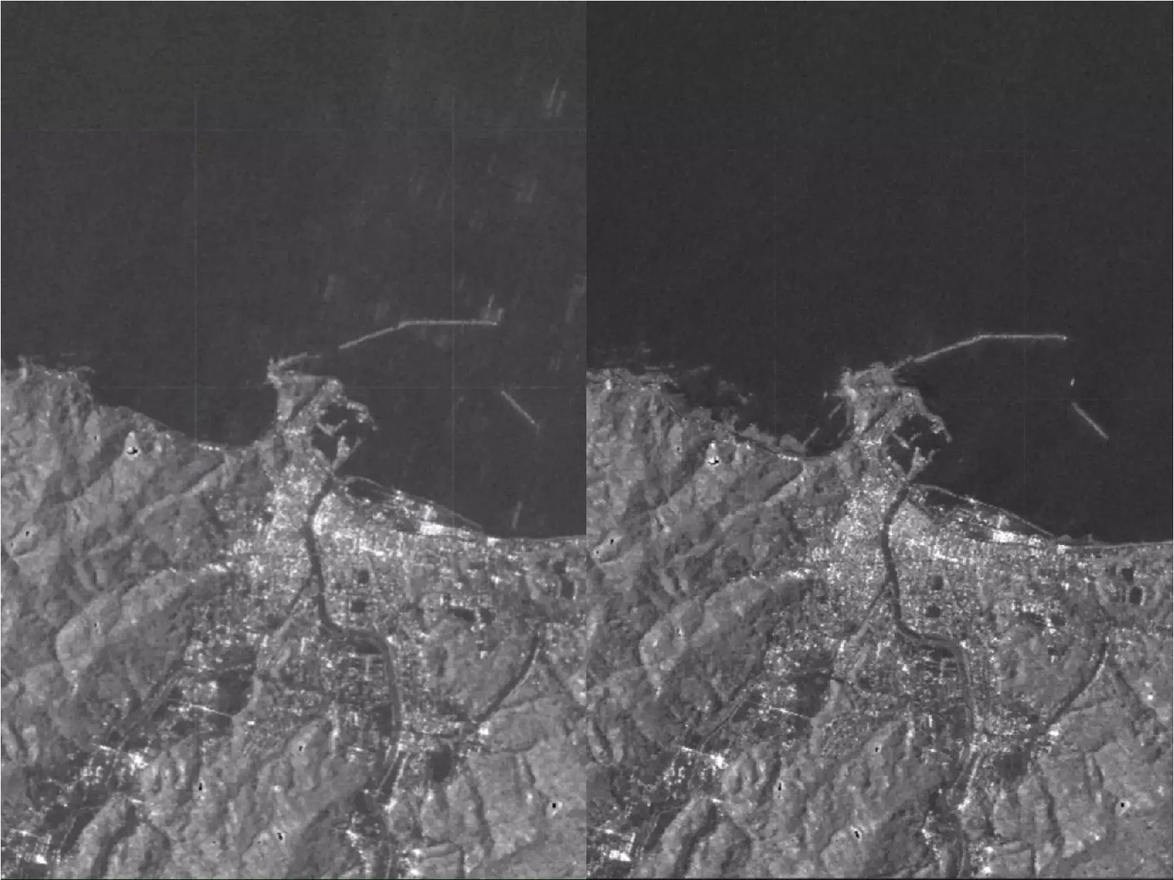
According to satellite imagery, Japan’s Noto Peninsula was rattled and slightly enlarged when a 7.6-magnitude earthquake struck on January 1.
Initial satellite analysis and ground surveys indicate that the earthquake caused coastal land to rise, a phenomenon known as uplift. The uplifted areas along the coast rose by as much as 4 meters, approximately 13 feet.
This implies that the sea floor along the coast has elevated above the water level in numerous locations on the Noto Peninsula, resulting in the formation of newly exposed beaches.
In certain areas, the earthquake extended the coastline by up to 250 meters, equivalent to approximately 820 feet, as reported by the University of Tokyo. This extension is roughly the length of 2.2 American football fields.
Residents who were fishing in a bay on the peninsula observed that “the entire coastline was uplifted during the earthquake, the uplift in the bay coincided with the earthquake, and the tsunami in the bay did not reach the elevated port,” as per the University’s statement. This information is based on a translation from Japanese to English using Google Translate. According to satellite
The Geospatial Information Authority of Japan published a preliminary satellite analysis of the Noto Peninsula. Comparing satellite images from June 2023 with images from the days after the earthquake, the agency identified multiple regions where new coastline has emerged.
The university said its investigation along the coast was ongoing.