
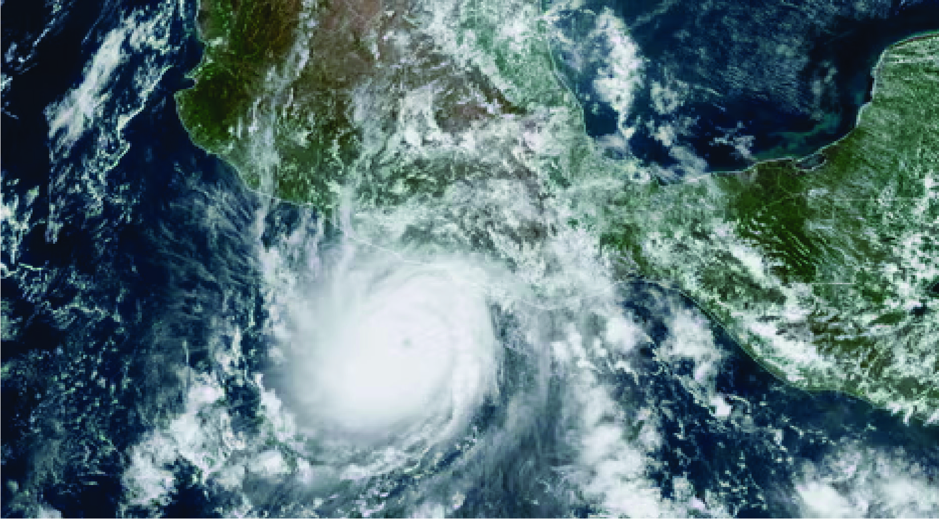
Hurricane Otis made landfall near Acapulco, Mexico, early Wednesday with maximum sustained winds of 165 mph, after rapidly intensifying from a tropical storm into a ferocious Category 5 storm within several hours.
Threat Level: Ahead of its landfall, forecasters issued dire warnings of “catastrophic damage.” The National Hurricane Center expressed deep concern in a late Tuesday forecast discussion, dubbing the situation a “nightmare scenario” as rapidly intensifying Hurricane Otis approached the southern Mexico coastline.
The hurricane center’s updates were emphatic about the peril, noting “life-threatening winds and catastrophic storm surge” upon reaching the coastal areas. The NHC also stressed that heavy rainfall from Otis would lead to flash and urban flooding.
The bigger picture: Over the past 24 hours, the storm underwent an “explosive intensification,” with its wind speeds surging by 110 mph. In modern times, this magnitude of intensification has only been exceeded by Hurricane Patricia in 2015, according to the hurricane center. Otis was projected to maintain its Category 5 hurricane status as it made landfall on Wednesday morning.
Data from the NHC indicated that maximum sustained winds had increased by approximately 80 mph within a 12-hour period on Tuesday. This marks the swiftest 12-hour intensification rate in the eastern North Pacific during the satellite era, as noted by meteorologist Philip Klotzbach from Colorado State University. Such rapid intensification episodes have increasingly been associated with climate change.
Current status: As of midnight Eastern Time, the hurricane was located roughly 45 miles south-southeast of Acapulco, with maximum sustained winds reaching 165 mph, along with higher gusts. Hurricanes with sustained winds of 157 mph or greater are classified as Category 5 storms. On Tuesday evening, hurricane warnings were in effect from Punta Maldonado westward to Zihuatanejo.
According to NHC forecasters, “This is an extremely dangerous situation, and all preparations for Otis should be rushed to completion.” maximum sustained winds
Between the lines: Studies show that tropical cyclones, including hurricanes, are intensifying more rapidly and with more substantial leaps as the planet experiences warming. Elevated ocean and air temperatures provide the necessary moisture for these storms, allowing them to intensify rapidly and shift categories in a matter of hours when conditions are favorable. Generally, forecasting rapid intensification, especially in the Atlantic Ocean Basin, has improved in recent years. In the case of Hurricane Otis, the intensification may be influenced by unusually warm waters associated with El Niño.
However, what raises concerns about Hurricane Otis is the speed of its intensification, which was not anticipated by official forecasts or major computer models. Until recently, those in the storm’s path were expecting only a tropical storm.
Of note: Hurricane Otis poses a historic threat to Mexico’s Pacific coast, with the potential to become the strongest landfalling storm in the region’s recorded history. The storm surge is expected to be devastating, particularly to the right of the storm’s center as it makes landfall, pushing water inland. Only the most robustly constructed buildings may withstand Category 5 winds, and based on its current trajectory, the core of the storm could impact an urban area housing about 1 million people.
What to watch for: Widespread flooding and mudslides are anticipated as Otis drops over 15 inches of rain on the southern state of Guerrero. Eventually, the storm could pose additional moisture-related threats in the United States. The NHC forecasts that Hurricane Otis will rapidly weaken after making landfall due to the higher terrain of Mexico.