
Tropical Storm Philippe is currently displaying disorganization, but meteorologists emphasize that we should not be overly concerned with semantics, as this storm system is anticipated to bring substantial impacts to Bermuda, and eventually, New England and Canada over the course of the next week.
Philippe’s forecast cone now encompasses nearly the entire state of Maine as it continues its northward trajectory through the western Atlantic Ocean in the coming days.
The FOX Forecast Center has pointed out that Philippe expected to interact with a robust low-pressure system over New England as it approaches, potentially leading to a complex and challenging weather forecast in the region.
Where is Tropical Storm Philippe?
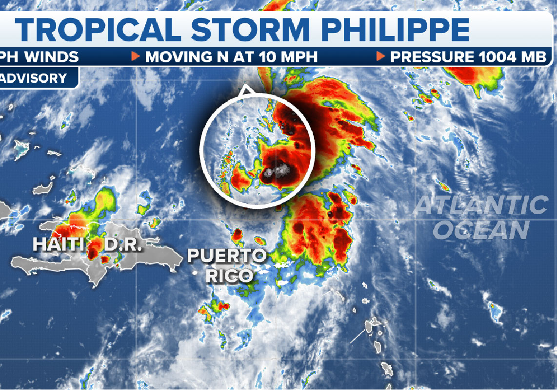
The National Hurricane Center (NHC) reports that Tropical Storm Philippe is gradually moving away from the U.S. and British Virgin Islands, as well as Puerto Rico. Philippe currently maintains maximum sustained winds of 40 mph, accompanied by occasional stronger gusts, and it positioned slightly more than 500 miles to the south of Bermuda.
A Tropical Storm Warning has issued for Bermuda, indicating that tropical storm conditions, characterized by sustained winds ranging from 39 to 73 mph, are likely to occur within the warning area within the next 36 hours.
The NHC forecasts rainfall accumulations of 3-6 inches in Bermuda through Friday. These substantial rainfall amounts have the potential to lead to isolated flash flooding in the region.
Where is Tropical Storm Philippe going?
Tropical Storm Philippe has shifted its trajectory to the north, traveling at an approximate speed of 13 mph. This northward movement projected to persist, eventually leading to landfall along the coastline of either Maine or Atlantic Canada.
Tropical Storm Philippe expected to maintain its northward trajectory due to the movement of a high-pressure system over the eastern half of the United States, which will shift eastward into the Atlantic Ocean.
The FOX Forecast Center has indicated that this eastward movement of the high-pressure system will play a role in directing Philippe toward Bermuda. Concurrently, a fall storm system progressing across the U.S. anticipated to reach New England by the end of the week, where it will interact with Philippe.
Significant rainfall expected well in advance of the main circulation of the storm. The precipitation from Philippe will converge with the rain associated with the fall storm. At present, it appears that the highest risk for flash flooding in the Northeast and New England will be on Saturday and Sunday.